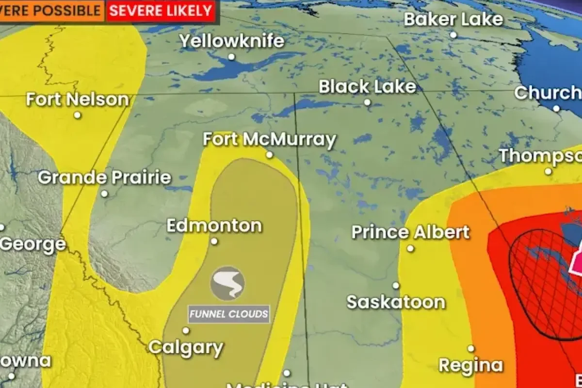
A slow-moving upper-level trough over central Alberta on Sunday created atmospheric conditions favorable for thunderstorm development and potential funnel clouds across a large area, including Calgary.
Weather conditions featured low shear, modest convective available potential energy, and rapidly developing cumulus clouds. According to reports, these ingredients often promote cold-core funnels.
>>> YouTube Creators Top Global Box Office, Reshaping Hollywood Demographics
Funnel Clouds and Landspout Tornadoes
Funnel clouds are rotating air columns that usually pose no danger near the ground. However, they can occasionally reach the surface and become weak landspout tornadoes.
Landspouts are significantly weaker than supercell tornadoes but can still topple trees, damage roofs, or toss debris short distances if they touch down.
Environment and Climate Change Canada (ECCC) issued a formal warning on Sunday.
>>> Former ATM Bomber Steven Kilian Releases Memoir After Prison Release
"These types of funnel clouds are generated by weak rotation under rapidly growing clouds or weak thunderstorms. This weak rotation is normally not a danger near the ground.
However, there is a chance that this rotation could intensify and become a weak landspout tornado," the agency stated.
Safety officials advised residents to remain weather-aware and monitor local advisories, watches, and warnings as conditions change quickly.
>>> Explosion and Fire Destroy Zwaanshoek Construction and Garage Companies
Nearby provinces also faced severe weather risks, with parts of Saskatchewan and Manitoba under separate tornado threats on Sunday.