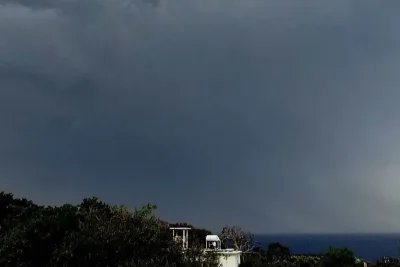
A line of severe thunderstorms swept across Minnesota on Wednesday, June 10, 2026, knocking out power to tens of thousands of residents and triggering widespread weather warnings.
The National Weather Service issued multiple severe thunderstorm and tornado watches as the system packed wind gusts up to 80 mph and large hail.
>>> City Crews Clean Oakdale Park Following Severe Salina Storm
Storm Damage and Power Outages
Severe weather risks mounted rapidly following a period of intense heat and humidity on Tuesday.
As the storm system advanced eastward from the Dakotas, it brought damaging straight-line winds and hail, leaving a trail of utility disruptions across multiple counties.
Electricity infrastructure sustained significant damage during the overnight hours.
According to tracking data from Xcel Energy at 3:45 a. m.
>>> Gunmen Kill 12 People in Cleveland Mass Shooting
, utility crews were responding to 460 distinct power outages that left more than 45,000 customers without electricity across the state.
The National Weather Service noted that the storm system produced winds of 60 to 80 mph in western and central Minnesota.
The Twin Cities metro area recorded initial wind gusts of approximately 40 mph.
>>> Economists: Growth-First Model Fails, New Roadmap Offers Better Path
Officials warned that a second round of severe storms could develop Wednesday afternoon and evening, bringing threats of large hail, isolated tornadoes, and localized flash flooding across Minnesota and neighboring Wisconsin.