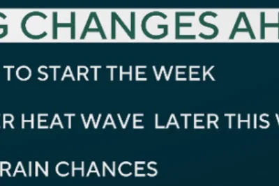
A high atmospheric pressure system developing over Texas on Sunday, June 7, 2026, will shift the recent active weather pattern in South Texas toward summer-like conditions.
This shift is expected to significantly decrease rain chances and elevate regional temperatures back to typical June levels.
>>> Toronto Police Boost Security for Pro-Israel Solidarity Walk
Recent Rainfall and Drought Relief
The upcoming change follows a highly active period that began in April. San Antonio recorded 16.27 inches of rain during that time.
That total represents more than double the typical amount normally received, effectively mitigating local drought conditions.
Sunday will bring mild and muggy conditions with low temperatures in the mid-70s under mostly cloudy skies. Temperatures will slowly rise to the low 80s by 10 a.
m.
San Antonio temperatures will climb to the upper 80s in the afternoon.
Surging humidity will create a severe heat impact, with "feels-like" temperatures reaching the upper 90s to 100 degrees.
The risk of precipitation remains minimal, with just a 10% to 20% chance of an isolated shower or weak thunderstorm.
>>> Winnipeg Pride Parade Bans Military Uniforms Amid Heat Warning
Monday will remain similar, though increased sunshine will push afternoon highs to around 90 degrees.
A few pop-up showers and thunderstorms are possible due to the Gulf sea breeze, with rain chances near 20%.
From Tuesday through Thursday, the high pressure will strengthen, pushing afternoon highs to 91 or 92 degrees, aligning with the early June average.
Daily lows will drop only to the mid-70s.
The most intense heat is projected for Friday and Saturday under partly to mostly sunny skies. Afternoon highs in San Antonio are expected to reach the mid-90s.
Persistent humidity will generate "feels-like" temperatures potentially hitting 104 degrees.
Long-range models indicate the high pressure system will likely weaken by early the following week.
>>> Toledo Police Hunt for Suspects After Shooting Wounds 12 at Festival
This could initiate the next period of widespread rainfall and potential isolated flash flooding, particularly during June 14-17.