A powerful cold front is expected to bring severe thunderstorms to Pittsburgh and Northeast Ohio on Saturday afternoon, June 6, 2026.
Meteorologists warn of damaging winds, hail, and the possibility of isolated tornadoes.
>>> Texas Gov. Abbott Deploys State Resources After First New World Screwworm Case
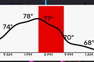
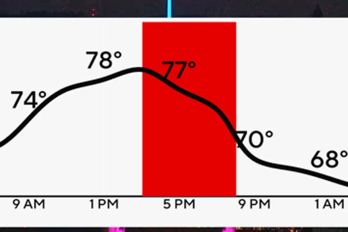
The Storm Prediction Center has issued a slight risk, level two out of five, for the Pittsburgh area.
According to the KDKA First Alert Weather Center, the threat peaks between 4 p. m.
and 6 p. m.
Wind gusts ahead of the storms could reach 20 to 30 mph.
Timing and Areas Affected
In Northeast Ohio, the National Weather Service in Cleveland reports the main storm window from 2 p. m.
to 8 p. m.
>>> Warner Bros Schedules Supergirl Early Screenings and Comic Giveaways
Areas near Cleveland and the lakeshore will see storms earlier, while southern cities like Akron and Canton face them later in the evening.
Morning humidity and daytime heating are expected to fuel atmospheric instability before the storm line organizes along the advancing cold front.
While rainfall amounts will generally be light to moderate, localized downpours could cause quick accumulation.
The severe weather system will push south of Interstate 70 after 9 p. m.
, leaving behind patchy overnight fog.
>>> Post-Prison Homelessness Drives Record High Deaths in England and Wales
Sunday is expected to be dry, with high temperatures climbing into the upper 80s and heat indexes reaching the 90s due to humidity.