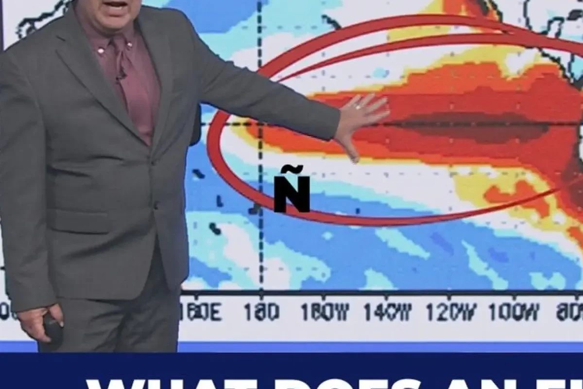
Meteorologists in the Pacific Northwest are tracking a developing "super" El Niño climate pattern that could significantly alter Oregon weather systems heading into autumn and winter.
The National Weather Service's Climate Prediction Center announced in mid-May that the weather pattern holds an 82% probability of emerging between May and July.
>>> District Judge Andrew Simpson Dismissed for Gross Misconduct
Understanding Super El Niño
An El Niño event involves the warming of sea surface temperatures in the equatorial Pacific, a phenomenon scientists refer to as the El Niño-Southern Oscillation cycle.
A super El Niño represents an intensified phase of this cycle, marked by ocean temperatures rising significantly above standard averages.
Historical records from the last five super El Niños in Portland, spanning from 1965 through the most recent occurrence in 2015-2016, are being analyzed to project potential impacts.
>>> Netflix Releases Miniseries and Documentary on Rachel Nickell Murder
KGW meteorologist Rod Hill is utilizing this data to outline what Oregon residents can anticipate regarding rainfall, snowfall, and mountain snowpack over the coming year.
"We're already above normal.
>>> Prince William Pledges Support for British Pubs During South London Visit
We've pulled out of the La Niña of last winter and then by the time we get into October, November, December, fall into early winter, we're up here in roughly two degrees Celsius above normal," said Hill.