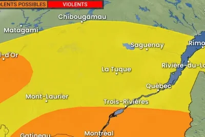
The National Weather Service issued multiple tornado and flash flood warnings on Tuesday night, May 26, 2026, as severe thunderstorm clusters capable of producing widespread significant wind damage swept through regions of Texas, Kentucky, and Florida.
In Texas, emergency alert systems sent immediate notifications to residents in Schertz, Universal City, and Converse just before 10 p.
>>> San Jose Police Arrest Suspect After Valley Fair Mall Shooting
m. , urging them to seek shelter as a dangerous cell rolled through the greater San Antonio area.
Officials cautioned that night conditions made visual verification nearly impossible, compounding the danger as the storm system brought imminent threats of heavy rain and destructive wind gusts to the affected communities.
Shortly after the initial alert, meteorologists expanded the emergency grid by implementing a flash flood warning for San Antonio, Universal City, and Converse that remained active until Wednesday morning at 1:15 a.
m.
The dangerous system tracked northeast of San Antonio, prompting further emergency extensions for Seguin and Belmont until 11 p.
m. as radar data confirmed intense rotating columns inside the storm cluster.
According to CPS Energy's chief meteorologist Brian Alonzo, radar tracking localized the rotation near Santa Clara, situated between New Braunfels and Converse, before a subsequent update officially verified the presence of the funnel.
"TORNADO HAS BEEN RADAR CONFIRMED!" reported Brian Alonzo, Chief Meteorologist for CPS Energy.
The emergency directives broadcast to local cell phones detailed specific safety protocols for residents caught in the path of the advancing storm cells.
>>> Brooklyn Food Cooperative Votes to Boycott Israeli Products
"Move to a basement or an interior room on the lowest floor of a sturdy building. Avoid windows.
If you are outdoors, in a mobile home, or in a vehicle, move to the closest substantial shelter and protect yourself from flying debris," stated the National Weather Service alert.
In a separate atmospheric development on Tuesday evening, the National Weather Service in Jackson, Kentucky, logged radar-indicated rotation inside a cluster of thunderstorms that originally materialized in Central Kentucky around 6 p.
m.
The localized rotation crossed Powell, Morgan, and Menifee counties before triggering a brief emergency warning for northeastern and southeastern sections of Kentucky, which subsequently expired by 10:15 p.
m. EDT.
As reported by WSAZ, the storm cell caused heat lightning across the night sky and downed power lines in Powell County, disrupting television broadcasts of the NBA playoffs with urgent weather updates before the warning was safely dropped.
Earlier that afternoon, the coastal region of Florida experienced similar severe patterns when an isolated, brief tornado touchdown occurred inside a construction zone located two miles north-northeast of Parrish.
>>> Apple TV+ Sets June 2026 Premiere for 'Cape Fear' Limited Series from Scorsese and Spielberg
Eyewitnesses in Manatee County observed a rotating funnel descend from the cloud base to lift construction debris before dissipating, matching a radar-indicated warning previously issued by the National Weather Service in Ruskin.