The National Weather Service and local emergency officials issued severe weather warnings and safety advisories across Texas on May 22, 2026, after intense thunderstorms brought threats of hail, high winds, and potential flooding to multiple counties.
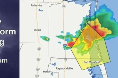
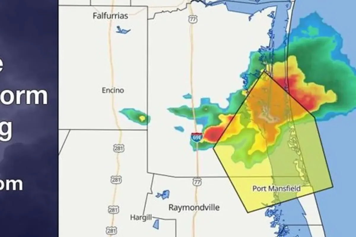
A severe thunderstorm warning for Willacy County expired Friday at 8:15 p. m.
>>> Transfer Student Wins Full Year of Free Tuition at University of Hawaii
following a tornado warning for Willacy and Kenedy counties.
The National Weather Service reported that the tornadic storm was heading toward Port Mansfield before it dissipated into strong, non-severe coastal storms carrying 40 mph wind gusts and pea-sized hail.
Simultaneously, a separate severe thunderstorm warning targeted North Texas until 2 a. m.
Saturday.
Forecasters warned residents in Alvord and northwest of Decatur to expect half-dollar-sized hail, continuous cloud-to-ground lightning, and wind gusts reaching 60 mph capable of damaging roofs, siding, and vehicles.
"At 1:06 a. m.
, a severe thunderstorm was located over Alvord, or 8 miles northwest of Decatur, moving east at 20 mph," explains the NWS.
Meteorologists emphasized that heavy rainfall accompanying the system could quickly spark flash floods, advising drivers to stay off inundated roads.
>>> USGS Warns Kilauea Volcano Could Erupt Over Holiday Weekend
According to the agency, around 25 million lightning strikes hit the United States annually, leading to approximately 20 fatalities, with risk peaking directly under the storm.
"For your protection get inside a sturdy structure and stay away from windows. Continuous cloud to ground lightning is occurring with this storm.
Move indoors immediately. Lightning can kill.
Heavy rainfall is occurring with this storm, and may lead to flash flooding. Do not drive your vehicle through flooded roadways," explains the NWS.
In South Texas, Cameron County emergency officials urged residents to clear nearby storm drains and gutters of debris to maintain proper drainage.
Emergency management officials highlighted that tree limbs, yard waste, and leaves frequently clog infrastructure and accelerate local flooding during downpours.
"They also need to avoid flooded roads, monitor weather updates, and keep important documents and supplies in a safe place, and readily available to be able to take with them if they need to depart from their homes," said Odee Leal, City of Brownsville Office Emergency Management Homeland Security Director.
Safety guidelines from emergency personnel recommend charging battery packs, securing loose outdoor items, and waiting 30 minutes after the last thunderclap before returning outside.
>>> NOAA Predicts Below-Average 2026 Atlantic Hurricane Season
To prevent hydroplaning on slick roads, officials advise motorists to reduce speed, avoid puddles, and gently ease off the accelerator if the vehicle begins to slide.