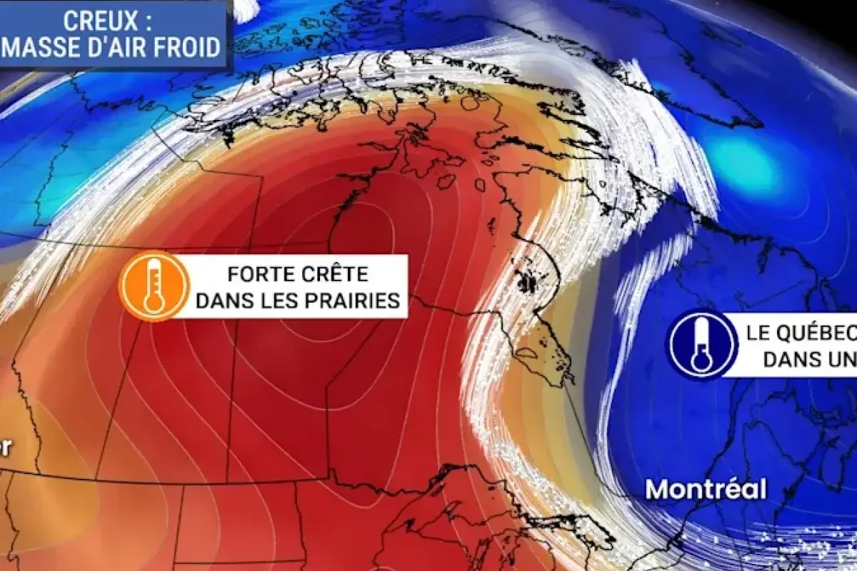
An atmospheric ridge moving eastward will bring warmer temperatures and sunnier conditions to multiple regions across Quebec starting early this week.
The weather shift follows a prolonged period of below-normal temperatures caused by an atmospheric trough.
>>> Calgary Jury Convicts Two Men of Murder and Armed Robbery
Meteorologist Kevin Cloutier reported that thermometers are expected to surpass 20 degrees Celsius in several areas.
The gradual warming trend will begin on Monday, leading to a significant shift between Tuesday and Thursday.
According to MeteoMedia, humidex values in the warmest regions could approach 30 during the peak of the afternoon.
The peak of the clear conditions is projected around Wednesday, providing favorable weather for outdoor activities throughout the province.
>>> Bus Driver Charged with Manslaughter After Fatal Virginia Crash
Forecasters note that the incoming warmth is an influx of mild air rather than a heatwave like the one recently observed in the Canadian Prairies.
The improved conditions offer a temporary break after a late May that closely resembled autumn weather patterns.
Meteorological models indicate that the summer warmth is not yet permanently established, as subsequent periods of atmospheric instability are expected.
>>> Washington Chemical Tank Rupture Death Toll Rises to 11
The upcoming shift represents a temporary seasonal pause before the next weather developments arrive.