A low-pressure storm system separated from the jet stream will linger over Central and Southern California through Friday, May 29, 2026.
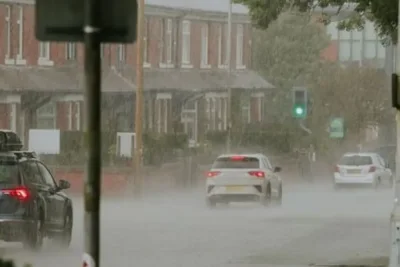
The system brings persistent marine layer clouds, patchy drizzle, and gusty winds to San Diego County.
>>> New Deep Sea Blue Octopus Species Discovered Near Galapagos Islands
Wind Advisory and Conditions
A Wind Advisory remains in effect for local mountains and deserts until 5:00 a. m.
Thursday.
West winds of 20 to 35 mph are expected, with powerful gusts reaching between 45 and 65 mph.
The stubborn marine layer will keep most coastal and valley areas under thick clouds throughout Wednesday.
Only partial clearing is expected late in the afternoon.
Light moisture accumulations ranging from a few hundredths to 0.10 inches may develop overnight and during the morning hours through Thursday.
Transition and Warming Trend
Weather conditions will begin transitioning on Thursday with slightly better clearing.
>>> Dutton Ranch Breaks Paramount+ Streaming Record with 12.9 Million Views
A faster clearing trend and warming temperatures will establish from Friday into early next week as a high-pressure system builds over the region.
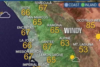
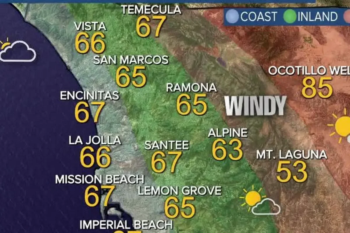
The weekend forecast indicates significant warming, with temperatures returning to near 70 degrees Fahrenheit at the coast.
Inland areas will see the 70s and low 80s, mountains the 70s, and deserts mid-to-upper 90s.
Marine layer clouds will clear gradually inland on Friday morning, though coastal areas will experience a slower clearing process.
Afternoon highs over the holiday weekend will remain seasonable for this time of year.
A gradual cooling trend follows due to a stronger onshore flow by midweek.
By next week, the weather is projected to become even warmer.
>>> Watchdog Finds Children Witness Extreme Violence in Custody Remand
Temperatures will hold in the 70s along the coast, rise into the 80s inland, approach 80 degrees in the mountains, and top 100 degrees in the deserts.