Widespread rain and thunderstorms are moving across Greater Cincinnati and the Tri-State region on Friday, May 22, 2026, threatening local events and prompting regional flood watches through the holiday weekend.
According to the National Weather Service in Wilmington, a steady feed of Gulf moisture is fueling the system.
>>> Two Air India Flights Face Emergencies: Engine Fire Alert and Tail Strike
It could drop up to two inches of rain on already saturated ground.
Flood Watch in Effect
The National Weather Service placed much of Northern Kentucky, southeastern Indiana, and southern Ohio under a flood watch from noon Friday through 5 a.
m. Saturday.
Flash flooding is possible in low-lying areas.
Initial showers began in Northern Kentucky around daybreak on Friday and are expanding north into Greater Cincinnati.
This creates wet conditions for the start of the Taste of Cincinnati festival.
>>> M6 Southbound Crash Causes Five-Mile Delays in Cheshire
Forecasters note that the heaviest rainfall will likely concentrate south and east of Interstate 71. Scattered, non-severe thunderstorms are expected near the Ohio River late Friday night.
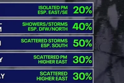
While rain coverage will decrease early Saturday morning, a separate disturbance tracking toward the Great Lakes will trigger renewed showers and afternoon thunderstorms until around 8 p.
m.
Weather conditions will begin settling on Sunday, bringing a mix of sun and clouds alongside lingering afternoon and evening spotty showers.
Daytime temperatures will approach 80 degrees Fahrenheit.
>>> DHS Issues Nationwide Alert for Comedian Over Immigration Satire Site
Memorial Day Monday will bring the most favorable outdoor conditions of the weekend. It will feature seasonable temperatures, more sunshine, and a reduced 40% chance of steady rain.