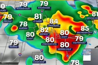
The National Weather Service issued a tornado warning and severe thunderstorm alerts for Central Indiana on Tuesday evening, June 9, 2026.
Radar indicated rotating storms and heavy rainfall threatening multiple communities south of Indianapolis.
>>> Glasgow Auction House Withdraws Human Bones from Sale After Ethics Backlash
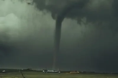
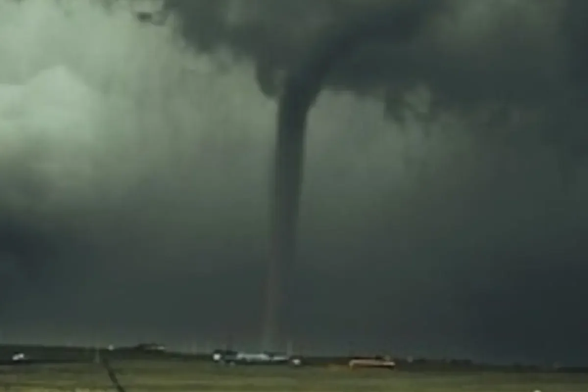
A storm near Franklin moved east at 35 mph, bringing risks of tornadoes, flying debris, damaged structures, and three-quarter-inch hail along the Interstate 65 corridor.
The tornado warning remained in effect until 10:00 p. m.
EDT for central Johnson and west-central Shelby counties.
Broader Severe Thunderstorm Warning
A broader severe thunderstorm warning covered Marion, Morgan, Hancock, Brown, and Bartholomew counties. Hazards included 60 mph wind gusts capable of damaging roofs, siding, and trees.
Impacted areas included Indianapolis, Greenwood, Franklin, Lawrence, Beech Grove, Martinsville, Speedway, Southport, New Whiteland, Cumberland, McCordsville, Whiteland, Bargersville, New Palestine, Meridian Hills, Brooklyn, Warren Park, Princes Lakes, Trafalgar, and Morgantown.
>>> Steven Spielberg Premieres 'Disclosure Day' in New York Ahead of Theatrical Release
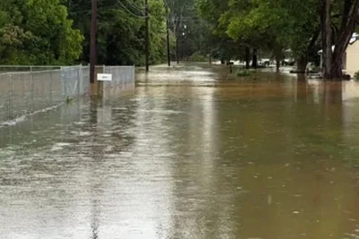
According to WISH-TV, an upper-level disturbance combined with high atmospheric humidity triggered widespread showers.
This compounded flooding risks in northwestern and east-central counties that previously received 2 to 4+ inches of rain.
WFIE reported that clearing skies on Wednesday and Thursday will push afternoon temperatures into the lower 90s.
High humidity will create heat index values between 100 and 105 degrees.
Meteorologists expect another cold front late Thursday into Friday.
>>> Ram Unveils 2027 Ram 1500 Rumble Bee SRT Muscle Truck
This will bring a renewed threat of straight-line winds, large hail, and flash flooding before a Canadian high-pressure system introduces cooler, drier air for the weekend.